January 28, 2020
The process for drawing a street in a pedestrian town is very different from in a town built around cars. Traveling on foot or on a bike presents an entirely different set of challenges, possibilities, and considerations than for travel in a car, and as a result the materials, size, shape, and even type of buildings on a street change along with them.
Drawing a Street in a Car-Based Town
For urban planners following car-based urbanism, drawing streets is a relatively simple process. The town or city is laid out, an idea of target neighborhoods and sectors roughly sketched first, and streets serve as the connections between these areas.
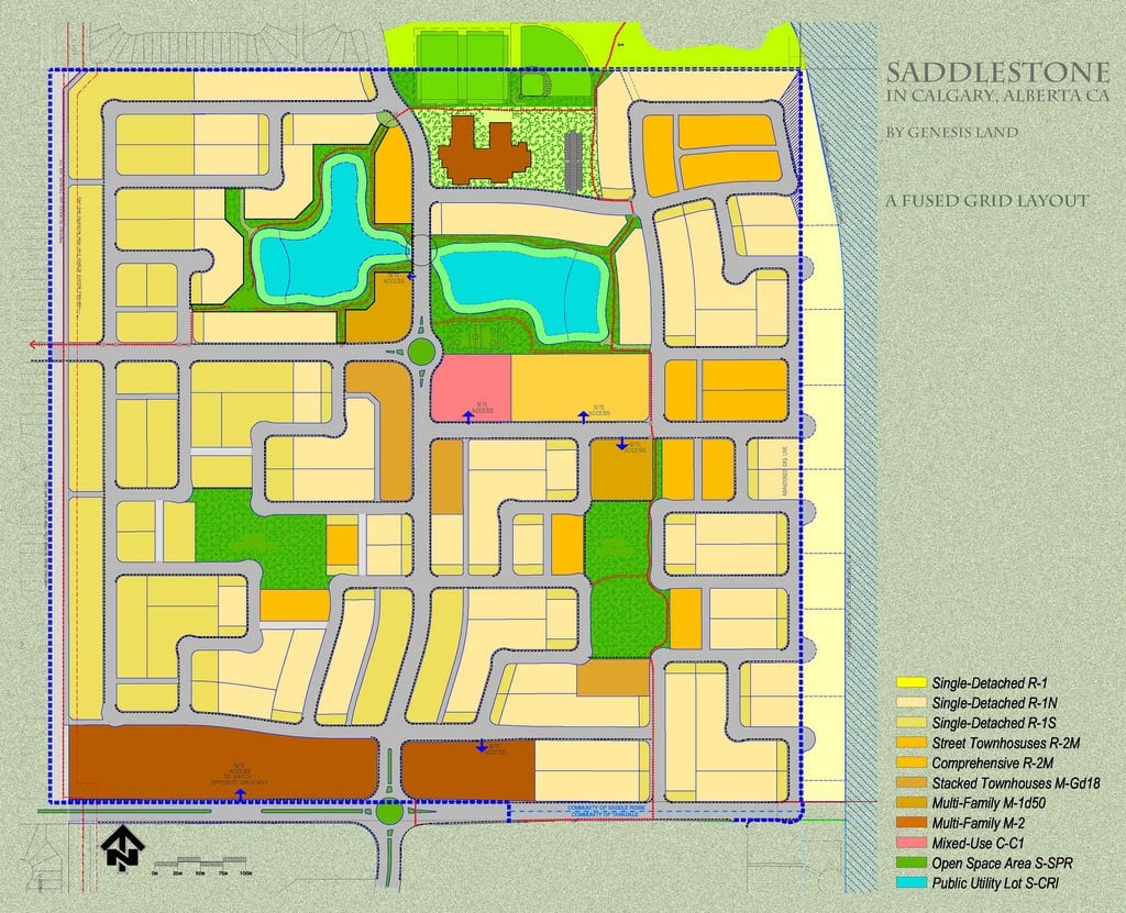
An example of a sample town plan. The land is divided up into lots, outlined by the network of roads. Within the city, the coding of the lot (with key at bottom right) provides the character of each neighborhood | PC: Commons
In this plan, a street is first drawn with a given width, number of lanes, and route to connect point A to point B, point C, point D, and so on. Then, the lots are drawn off of the street, and a building code determines which types of homes and buildings can exist, how tall they can be, and how they need to interact with the street.
In essence, the design process is:
Determine sectors/neighborhoods → Draw streets that define these areas → Assign lot coding to homes and buildings based off of the requirements of the streets
How This Process Changes for a Pedestrian Street
Things are very different when you draw a pedestrian street, mainly due to flexibility in design. A car-based street is somewhat limited by the size, speed, slope, and lanes that cars require, whereas a pedestrian street has far fewer requirements. This means that a town planner can prioritize the homes, lots, and sense of the street first, and then inform the design of the street.
In many ways, the difference between a pedestrian street and the car-based street is how they can be treated as space. The car-based street is positive space, laid firmly onto the town plan with a number of restrictions. A pedestrian street can be the same, laid firmly onto the town plan with a set width, design, slope, etc. However, a pedestrian street also has a much greater ability to be designed as negative space, with its shape, form, and slope dictated by the layout of the homes, squares, and buildings around it.
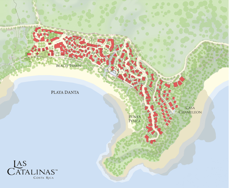
In Las Catalinas, homes (in red) are laid out first, considering views, privacy, and topography of the land. Due to town's walkability, the roads can follow non-linear paths, and both grow and shrink depending on the needs of an area
Pedestrian Streets are A Cyclical and Simultaneous Process
The flexibility of a pedestrian street provides many more possibilities to fine tune the street, homes, and buildings to create a truly cohesive and beautiful neighborhood. However, prioritizing a harmonious relationship between all of the elements of neighborhood does introduce a complication to the design process.
In this method of town design, the layout of street and the character of buildings in a pedestrian town plan are interconnected in both directions. The layout of the street will influence the types of homes and buildings on it just as much as the intended design of the buildings and homes will dictate the feel of the street.
The street at the end of Avenida la Antigua has a vastly different style than the Plaza Danta section of Paseo del Mar, as it should, as the two areas offer something different to town's urbanism
For example, a lively road centered around shops and stores will have a very different size, shape, and feel than a quieter residential road. So until the buildings themselves have been decided on, it can be difficult to draw out the road linking them. At the same time, the street has to be sketched out to even give an idea of what types of homes and shops can exist there.
This is the cyclical nature of the street design process.
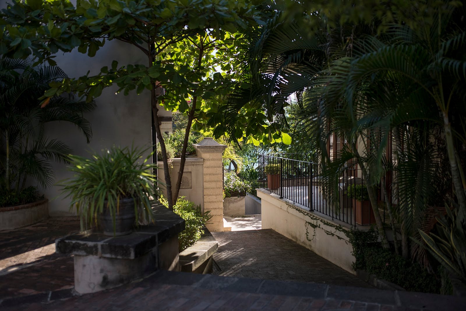
One further consideration of this process is the three-dimensionality of streets. For example, a well-designed walkable street is actually laid out differently (narrower and taller) than a car-centered street (wider and shorter). Another example is that a street going down a hill must be designed differently than a street on flat ground, so as not to create the feeling that the buildings are going to slide, or are leaning.
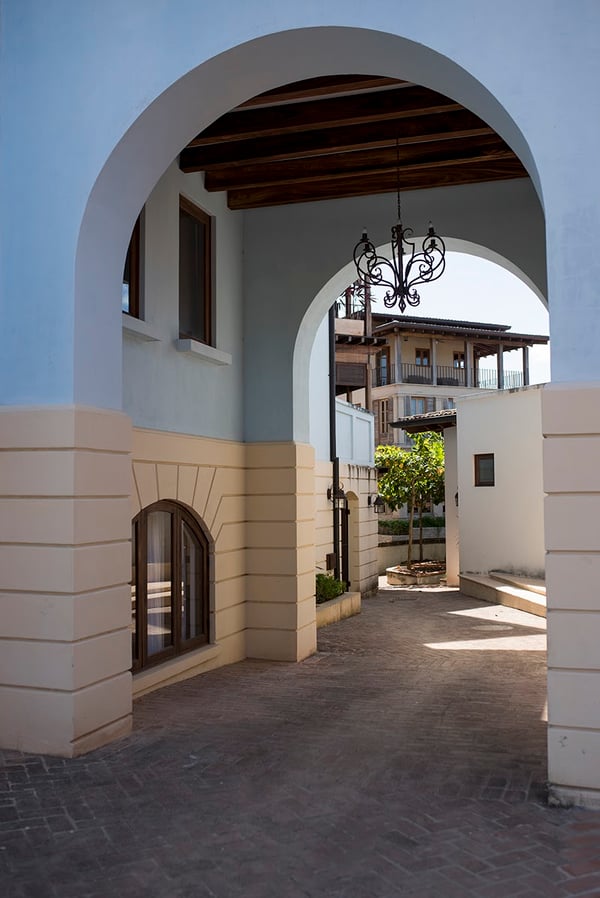
An example of these proportions shown literally. This archway between 7 Calle La Ronda and 5 Calle La Ronda is shaped in a way that evokes the human proportion, not that of a car, and in doing so makes it feel more natural to walk through, rather than drive
All of these factors mean that the height of the buildings has to respond to the structure of the street, and vice versa. However, the buildings on a street don’t exist in a vacuum, and have to align with the other streets of their sector and neighborhood, which adds a further layer of consideration.
Drawing Pedestrian Streets in Generative Urbanism
The ultimate benefit of the pedestrian street design process is that, when done right, the whole neighborhood feels cohesive, walkable, beautiful, and natural, as each element has been adjusted into harmony with the others. However, as town architect Sara Bega explains, “it’s a bit like a spider’s web. You can’t pull one strand, adjust a street or plaza for example, without affecting every single other thing around it, and maybe a few things two or three layers past it.”
This is where town’s generative urbanism comes in. By starting with a ‘seed’ of homes and buildings as a base, which in Las Catalinas was the original homes along Paseo del Mar as well as Pura Vida Ride, part of the urban plan is very literally set in stone. As the ensuing layers of homes, shops, and public spaces come together, these completed layers help inform the later designs. The presence of a few guiding principles, like town has, can also make simpler this creation process, resulting in a process of cohesively designed, organic streets.
The Characteristics of Streets in Las Catalinas
There are a few notable characteristics of the streets in Las Catalinas. First, the layout of the road network due to town’s complex topography as a hillside town.
In many hillside towns built around cars, roads travel parallel to the hills, and hug the natural topography as they wind up and down. For the driver of a car, this means a long and looping trip to get from the top of the hill to the bottom.
Parts of town are built in the slow-sloping style of many car-based hill towns, allowing bikes to easily traverse the landscape in a smooth, looping path
Town follows this traditional model with some of its bikeable streets, like Calle La Ronda, which gradually descends from Copper & Stone through town all the way down to the beachfront at Plaza Danta. However, town also has stair streets that provide connections running perpendicular to the topography, like the stairs from Calle Cartagena to Paseo Árbol, or the multiple stairs from Paseo de los Niños to Calle La Ronda. These stair streets would be far too steep and tightly designed for a car to travel, but for a pedestrian they provide an easy-to-traverse network across town’s complex topography.
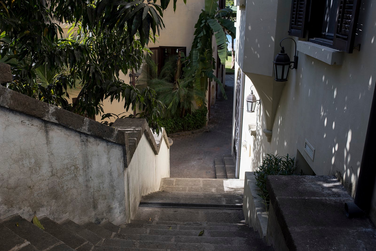
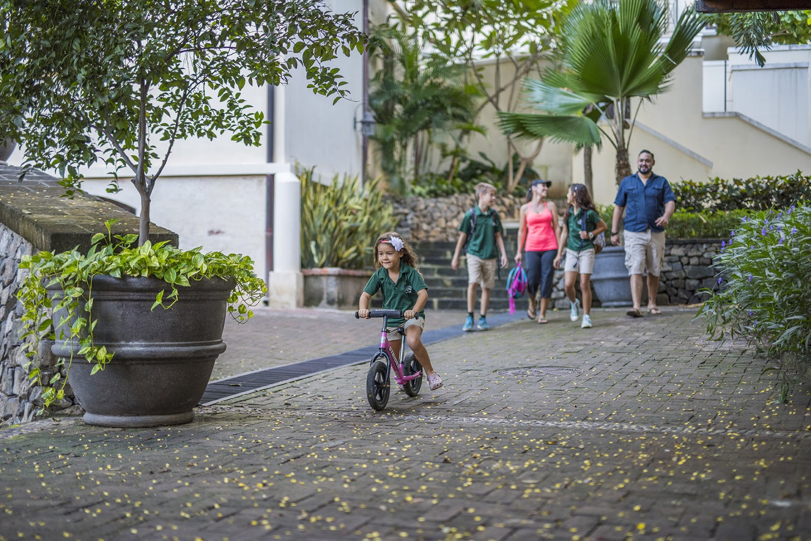
A street that is perfectly reasonable for the pedestrian to navigate, but impossible for the motor vehicle. Part of the possibilities made real by pedestrian streets
The second characteristic of all streets in town is that they are intentionally designed to serve as pedestrian connections between the many plazas, places, and points of interest along their length. For a car, and when traveling for speed, the best connections are a straight line, but for the pedestrian experience this isn’t actually true. Long, straight sight lines to a distant target actually make the walk feel longer and less interesting, as the view does not change for the duration.
Instead, in Las Catalinas the streets intentionally wind and twist slightly, drawing the eye around corners and never presenting a vista more than a few hundred yards. This is where the presence of plazas, fountains, and landmarks comes in.
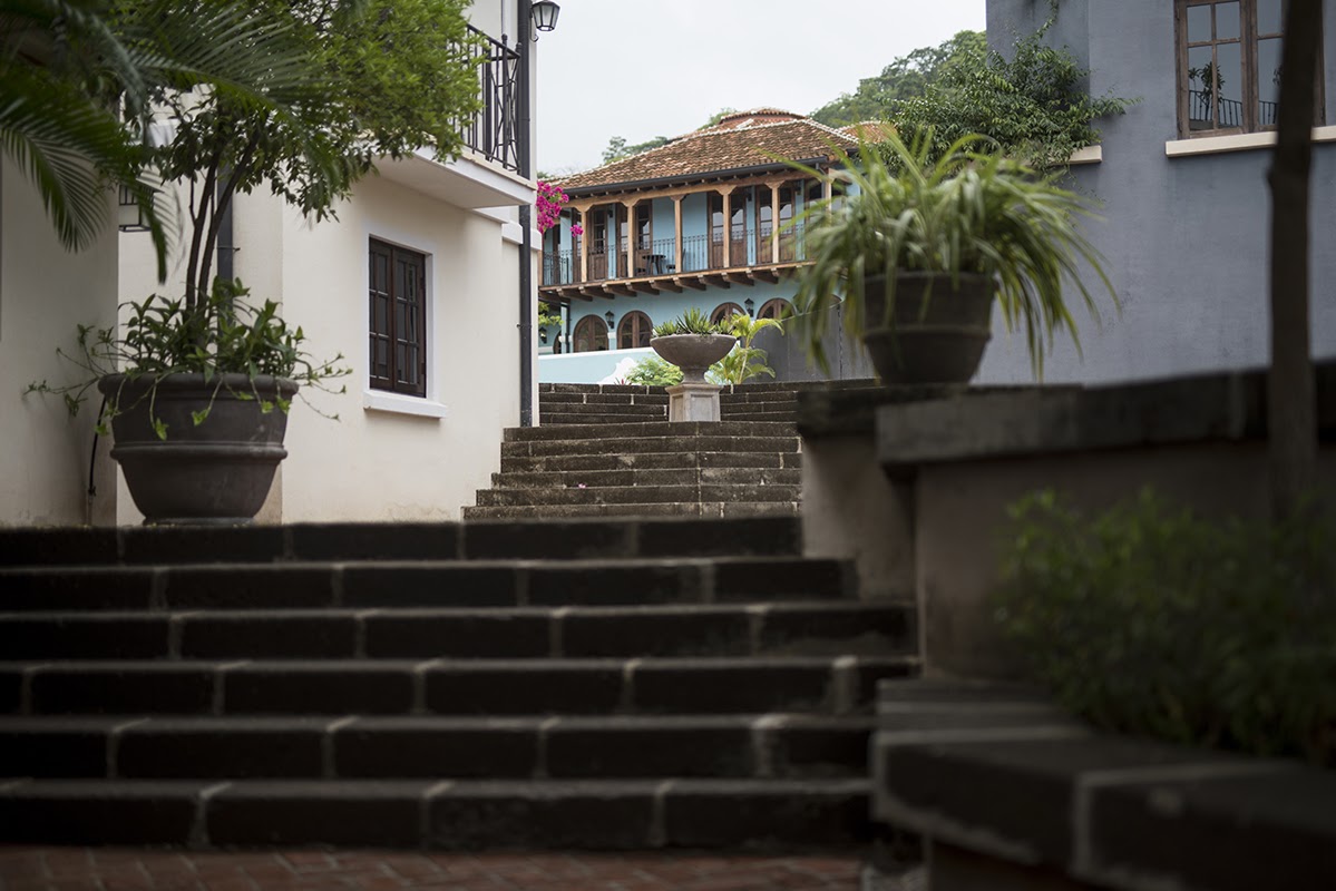
Each segment of road in Las Catalinas is built intentionally to include landmarks and a 'link' between places. This process of small rewards enhances a walk through town
The human cone of vision is sixty degrees in every direction, and within every sight line on town’s pedestrian streets there is a visible plaza, space, or other notable object to reach and then continue on. As a result, the trip is broken up into many small chunks each with a form of ‘reward’ at the end, which makes the walk feel shorter and more interesting, even though it was not strictly speaking the fastest route.
Finally, the materials and landscaping of all of town’s streets are designed with high standards for the pedestrian experience. Materials are chosen that are cool, soft, and satisfying to walk on barefoot. Flowers contribute to the beauty of the walk, serving as both landmark and splash of color, while shrubs and trees help shape sight lines and provide shade for those on the street.
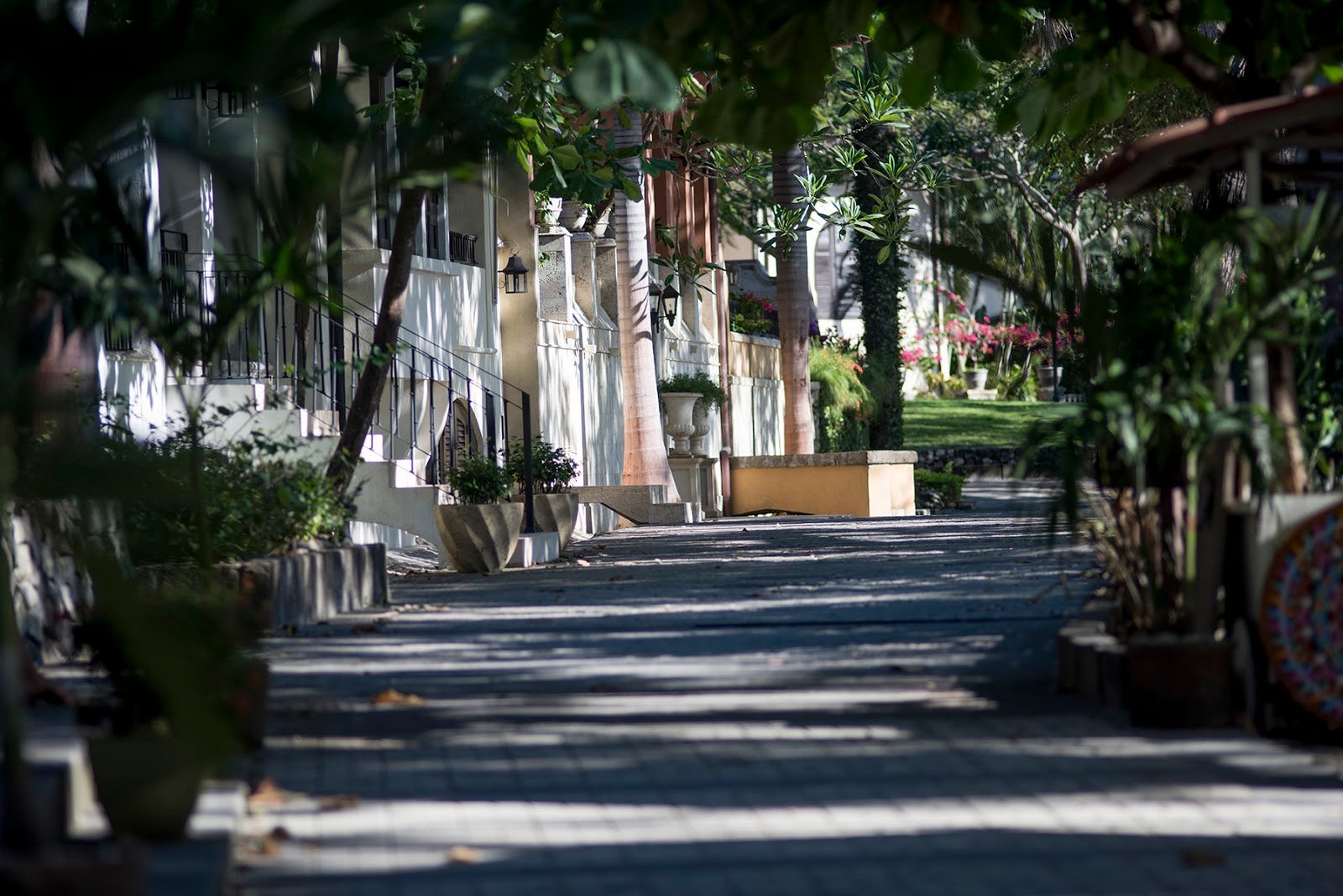
All three uses of greenery can be found along Paseo del Mar. Flowers offer a landmark and beauty, trees provide shade, and the shrubs and plants help guide the sight lines such that even this long, oceanfront road can be broken up into small, easily walkable chunks
In all, these principles help guide the design of town’s streets from urban plan to creation, forming a fundamental part of living in this walkable town.
Take a Walk Through Town
Building a walkable, beautiful town does not happen on accident, but if done right, a town just feels good to be in. When walking along the streets of Las Catalinas, you are surrounded by countless thoughtful decisions, which combine to create a place that feels natural, timeless, and great to live in.