Clear navigation is one of the reasons the Las Catalinas trail system feels so approachable, even for first time users. A major effort has gone into creating maps that are legible, safe, and easy to use for everyone. The map works hand in hand with a consistent set of trail markers that have been placed throughout the property, so you can match what you see on the ground with what you see on the map and navigate with confidence. These markers also serve a second purpose beyond orientation. They make it easier to give directions and request assistance in case of an emergency. Every marker is unique, and each one has been georeferenced.
February 1, 2026
Editorial Note
Because of the depth of research behind this entry, this story is shared in chapters rather than sections. If you are here looking for a quick guide to recommended routes shaped by long-time trail lovers and avid users, feel free to jump straight to Chapter Four.
If you are interested in the history, vision, and origins that shaped the 40 km (24.9 mile) Las Catalinas trail system, we invite you to begin with Chapters One through Three. Together with Chapter Five, they tell the story of how intention, design, and movement guided the trails long before Town existed, and how that legacy of movement and care for the surrounding ecosystem continues to shape the way many people connect to nature, to others, and to themselves.
Chapter One: The Vision Behind the Las Catalinas Trail System
Before Town, There Were Trails
Long before the first house was built in Las Catalinas, the trails were already being imagined.
From the very beginning, Las Catalinas has been guided by a clear set of values and long-term goals that have shaped every decision along the way. In previous entries of The Blog, we have shared some of those principles, many of them unconventional, that allowed the project to strike a careful balance between development and care for nature. We have also spoken about Well Living values such as walkability, connection with nature, and community, and how those ideas were translated into the Master Plan of Las Catalinas.
Las Catalinas’ trail system is one of the clearest and earliest expressions of that vision. Before there was a Town, there was already a deep intention to move through the land on foot. The trails became the very first amenity in Town, and for many of the earliest homeowners, they were the reason to choose Las Catalinas in the first place.
Walkability in Town is not simply an aesthetic choice; it is the prioritization of human movement over vehicles. That freedom of movement brings a particular kind of peace: peace of mind in terms of safety, and peace in knowing that moving through Town is both enjoyable and intuitive.

That same philosophy extends beyond streets and plazas and into the surrounding landscape.
Movement in Town is made possible through a carefully designed sequence of streets, passageways, small squares, fountains, stairs, and ramps that connect every point seamlessly. This network allows people to flow naturally from one place to another. It is no coincidence, then, that connectivity became a defining principle of the Las Catalinas trails as well.
Just as the architecture of Las Catalinas draws inspiration from historic Mediterranean towns, the trails were also informed by a powerful reference: Cinque Terre. Along that Italian coastline, five villages are connected by footpaths, allowing people to walk from one town to the next, stop along the way, and experience each place at a human pace. That idea of continuity, of taking a trail and ending up somewhere meaningful, deeply influenced how the trails of Las Catalinas were conceived.
Connectivity and mobility are often discussed as key principles behind the design of Town, but they are just as present in the trail network. Here, trails are not isolated paths. They are part of a larger system that allows people to move through the land with intention, ease, and curiosity. One can begin a walk in Town, follow a trail, reach a lookout, arrive at the beach, and return by a different route without repeating the same experience.

From the beginning, the trails were imagined as more than recreational paths. They were designed as infrastructure for daily life, as spaces to move, explore, and connect, with the land, with others, and with oneself. Over time, they would also become essential for fire prevention, environmental management, and long-term stewardship of the landscape.
At their core, the trails represent a simple and powerful idea: that the best way to understand a place is to move through it slowly, on foot, following the natural contours of the land.
_________________________________________________________________________________________________________________________________________________________________________________________
Chapter Two: How the Las Catalinas Trails Were Designed and Built
While the trails may feel intuitive and effortless to walk or ride today, their design was anything but accidental.
From Mountain Biking Origins to a Purpose Driven Trail System
In their earliest days, the trails of Las Catalinas were conceived with a very specific purpose in mind: mountain biking. Although today they are widely used for hiking and trail running, their original function shaped every design decision that followed.
Before 2008, an external proposal had been considered for developing trails in the area, but it proved unfeasible. At the same time, early members of what would later become the Agroforestry and Environmental team had already opened a few informal paths across the land. These, however, followed straight lines up and down the slopes, resulting in steep inclines that were extremely demanding. They were difficult not only for mountain biking, but even for hiking or trail running.

Everything changed in 2008 with the arrival of Las Catalinas’ current Environmental Director. While he already had experience designing natural history trails, the technical demands of mountain biking required a different level of precision. This led to an intensive learning process: studying the singletrack standards established by the International Mountain Bicycling Association (IMBA), while simultaneously developing a deep, hands on understanding of the terrain itself.
The land presented challenges as the slopes were complex, the soil varied, and at the time, the available workforce did not yet have the technical training required to build sustainable trails. Rather than rushing the process, the decision was made to invest in people.

Between 2008 and 2009, extensive training sessions were organized for the team. These workshops, supported both internally and by external specialists, focused on trail construction techniques such as building steps, ramps, and compacted earth paths.
That year of learning laid the foundation for everything that exists today.
IMBA Standards and Sustainable Trail Design
Through this process, the team acquired the technical principles and skills necessary to build sustainable trails. These are defined by IMBA as self managing trails, meaning that they shed water efficiently, prevent erosion, and require minimal maintenance beyond vegetation control. This stands in contrast to poorly designed trails that allow water to run directly along the path, creating ruts, gullies, and muddy sections that quickly deteriorate.
The trails follow both IMBA standards and key engineering principles commonly used in road design, including slope control and proper banking. For mountain biking trails in particular, this translates into consistent flow. As a result, all mountain biking trails were designed with an average grade of approximately ten percent, a threshold that balances rideability, safety, and long term sustainability.

In 2009, the first two kilometers (1.2 miles) of official trail were completed, specifically the section connecting C1 to C2. This marked the beginning of the formal Las Catalinas trail system in Town.
Stackable Loops and a Hand Built Trail Network
From there, the network grew thoughtfully. Using the land’s contour lines and the Master Plan of the development, the team identified key points that needed to be connected: viewpoints, beach access points, perimeter routes, and strategic locations across the property.
The trails were developed in phases, each one refining technique and improving execution. Access points such as A1 through A6 were established to reach optimal elevations and connect back into the main loops. Primary routes were prioritized first, especially those offering ocean views or reconnecting naturally with Town. From these, secondary trails branched outward, allowing the system to expand in multiple directions while maintaining coherence.
.jpg?width=1441&height=1081&name=Image%20(10).jpg)
Every new section began with a destination in mind. Once that point was defined, the route was traced carefully, always respecting slope limits, drainage requirements, and flow.
Although the terrain was far from easy to work with, the results exceeded expectations. The trail system, officially completed in 2022, is now composed of nine multipurpose trails shared by mountain bikers and hikers, and five hiking only trails reserved exclusively for pedestrians. Together, they form a network of loops, connectors, and access routes that function as a web of independent yet complementary paths.
.jpg?width=4032&height=3024&name=Image%20(12).jpg)
This configuration allows users to customize their experience. One can extend distance and difficulty simply by adding loops, shorten a route using connectors, or create long continuous rides with virtually unlimited variations. Just as importantly, these connectors provide alternative routes in case of emergencies.
____________________________________________________________________________________________________________________________________________________
Chapter Three: Stewardship, Navigation, and Land Management
The trails of Las Catalinas were never designed as recreational paths alone. From the beginning, they were conceived as part of a broader land management strategy, where enjoyment, safety, and ecological care could coexist.
Trails as Firebreaks and Land Management Infrastructure
The trail network plays a fundamental role in wildfire prevention. Because trails are consistently cleared and maintained, they function as effective firebreaks, slowing the spread of fire and providing accessible lines of defense. In the event of a wildfire, these trails become stable corridors where containment efforts can be anchored.
Additional firebreaks throughout the property are intentionally designed to connect directly to the trails. In wildfire management, defense lines are never opened randomly. Instead, they are anchored to an existing line, locally known as a ronda. At Las Catalinas, the trail itself serves as that anchor, allowing fire prevention work to be carried out without unnecessary disturbance to the land.
.jpg?width=2557&height=1918&name=Image%20(11).jpg)
Beyond the internal network, the property is protected by a perimeter firebreak approximately eight meters wide. While it does not follow the exact boundary of the land at every point, it forms a continuous protective ring. This perimeter is cleared twice a year, most recently between November and December, with only light touch ups required if conditions demand it. New lines through untouched terrain are avoided whenever possible, preserving both the ecosystem and the well being of the team.

A Minimal and Intentional Approach to Trail Maintenance
Trail maintenance at Las Catalinas is intentionally preventative rather than reactive. Thanks to the original design, which prioritizes proper drainage and durability, upkeep focuses mainly on vegetation control and safety. Fallen branches are removed, loose stones are cleared, and small repairs are made as needed.
During the dry season, vegetation trimming typically occurs every two to three months, while in the rainy season it happens approximately every six weeks. The goal is to maintain safe and functional trails while allowing the land to remain as natural as possible.

This layered, interconnected system would later prove essential not only for recreation, but also for long term land stewardship.
Navigation, Signage, and Orientation
.png?width=7087&height=5907&name=Sistema%20de%20Senderos%20Mayo%202024%20(1).png)
Signage throughout the system is intentionally minimalistic, using a clear alphanumeric and color code. The bright colors are designed to catch the attention of hikers and riders and help people quickly locate where they are and where they need to go next based on their preferred route. Only a few locations keep proper names, reserved for key geographical landmarks such as Playa Danta, Playa Dantita, McHenry Peak, Punta Guachipelín, Punta Penca, and a few others.
Markers were strategically placed along each trail to make navigation simpler. Think of them as easy to use coordinates made up of the trail letter and the station number, exactly as shown on the map. And there is a detail that quietly carries the origin story of the trails. Every sign was handmade by the Agroforestales team, carved and painted using salvaged wood from the farm and recycled materials. It is a small but meaningful reminder that more than a dozen hands shaped these paths with care, one section at a time.

The complete system consists of 40 km, or 24.85 miles, and has three official trailheads at A1, A6, and B13, along with many additional entrances and exits throughout the network. There are nine multipurpose trails labeled A through I. While all of them can be hiked, they were designed with mountain biking in mind, and Trails G and H are dedicated one way downhill singletrack. With grades that reach about 25 percent, they offer a very Las Catalinas kind of downhill, more family friendly than aggressive, built to prioritize flow, fun, and safety over steepness that could increase accidents. The steeper hiking only trails, better suited for hiking and trail running than mountain biking, are labeled J through N.
The map offers guidance, not rules. Understanding how the system works is the first step. The next section builds from these markers and suggested routes, sharing the most loved combinations recommended by long time trail users and inviting you to explore the system in countless ways. Now, let’s step into the trails. This is where the true fun and magic begin.
________________________________________________________________________________________________________________________________________________
Chapter Four: The Best Routes for Mountain Biking and Hiking in Guanacaste, A Guide to Using the Las Catalinas Trails
This chapter brings together some of the most loved and frequently recommended routes in the Las Catalinas trail system. They are organized by discipline and difficulty level depending on the fitness level.
Below is a quick overview to help you orient yourself before diving into the details of each route.
Quick Route Overview
Mountain Biking
| BEGINNER FRIENDLY | Little Loop | ~45 minutes to 1 hour |
| INTERMEDIATE TO ADVANCED | El Secreto (D Trail) Big Loop | ~1 to 1.5 hours |
Hiking Routes
| SUPER EASY | Punta Penca (PP) | ~30 minutes |
| EASY OPTION 1 | Lollipop Loop | ~1 hour |
| EASY OPTION 2 | Sunset Hike | ~1 hour |
| INTERMEDIATE OPTION A | El Cielo (EC) | ~1 hour |
| INTERMEDIATE OPTION B | Long Intermediate Hike | ~2 hours |
| ADVANCED | McHenry Peak and Windy Peak | ~1.5 hours |
Mountain Biking Routes
Even though all trail gradients in the Las Catalinas trail system were designed to be flowy and rideable, it is important to remember that these are single track, one way trails. The riding surface is narrow, and in many sections you will encounter exposed cliffs on one side and mountain faces on the other. Riding with proper safety equipment and staying alert to other bikers is essential.
If you are new to mountain biking in Las Catalinas, starting with an e-bike is highly recommended. It allows you to become familiar with the terrain, understand the technical demands of the trails, and manage the endurance challenge that comes with elevation changes, while still fully experiencing the system.
Elevation is one of the main challenges for riders. The most demanding climbs are found on the C and I trails on the way up, so beginners may want to avoid these at first. The rest of the network offers excellent entry points for intermediate riders, with difficulty largely depending on fitness level. The trails can be enjoyed year round, though many riders favor the rainy season, when the soil firms up and rides are best enjoyed in the mornings. As always, carry a helmet, water, electrolytes, and a basic repair kit.
1. BEGINNER FRIENDLY | Little Loop | ~45 minutes to 1 hour
If you are new to mountain biking and excited to explore, there are two great loop options that start from the same point.
The starting point for this adventure will be at the trailhead A6, followed by A5, A4, A3, then continuing through B1 and B2. Once you reach B3, you have the option to take a fun and flowy downhill by following D1 all the way to D3, then taking the connector N1 to B6. From there, you continue along the B trail through B6, B7, B8, B9, B10, and finish at B13.
If you prefer a shorter ride or are limited on time, after reaching B3 you can skip the D trail and continue directly to B4, staying on the B trail until you get to B12 and then reach B13, right in front of Casa Chameleón.

The difference between these two options lies in the experience. The D trail offers a more immersive nature feel, with glimpses of the shimmering ocean and the gentle movement of tree branches and leaves creating a refreshing breeze along the way. Both loops take approximately 45 minutes to one hour, depending on skill level.

2. INTERMEDIATE TO ADVANCED | El Secreto (Big Loop) | ~1 to 1.5 hours
El Secreto or Big Loop route is the favorite among experienced mountain bikers in Las Catalinas. It is composed of multiple established trails and offers a dynamic and varied ride. Starting on the front side of the trail system, it provides expansive views of Town and the ocean before transitioning to the back side, where you can see Playa Manzanillo and loop nearly all the way to Zapotal before returning to finish in front of Casa Chameléon, just above Beach Town.

The route is ridden clockwise, starting at trailhead A6 and continuing to A5, A3, B4, and then into the D trail at D1. From there, you follow the D trail all the way to D13. After completing this section, continue through B11, B12, B10, and B7, where you enter the I trail. This final section brings you back to A5 and A6, completing the loop.
Beginning at A6 offers a gentle warm up with gradual climbing and views of Town, Playa Danta, and Playa Dantita. Most of the A trail involves climbing, but once you reach the B trail the ride becomes smoother, once again opening up to ocean and Town views before leading you into the D trail.

From D1 to D7, the trail is extremely flowy and well shaded, with ocean views along the way. Between D1 and D4 there is minimal elevation change, but plenty of playful ups and downs. The section from D4 to D5 is significantly steeper and requires strong pedaling, offering a full cardio workout. At the end of this climb, you are rewarded with a lookout that feels well earned.

From D5 to D7 lies a section known as The Carrot, a long downhill stretch that many consider the most flowy part of the entire system. It requires very little stopping and is especially enjoyable during the rainy season.
At D8, you will encounter a small gate and a gravel road used by vehicles. Carefully walk your bike to the right along the road. A few meters ahead, you will see the sign marking D9. From there, remount and continue through D10 and D11. This section is particularly loved during the rainy season, as it crosses small streams and remains heavily shaded. The climb here is gradual until reaching the final challenging ascent from D11 to H5, known among riders as the Switchback due to its back and forth movement.
Once you reach H5, the toughest climbing is behind you. From this point on, the ride becomes increasingly flowy and downhill. From B7 onward, it is possible to ride nearly all the way back to the trailhead without pedaling, although careful braking is required.
This route is approximately 16 kilometers (10 miles long). An intermediate rider can expect to complete it in about 1.5 hours, while advanced riders may finish in around one hour. Additional distance and difficulty can be added by riding toward Zapotal Beach before reconnecting at D9 or D10.
Hiking Trails in Las Catalinas: Routes by Difficulty and Time
As mentioned earlier, the trails were originally designed for mountain biking, but they are widely used for hiking and trail running. Trail etiquette gives bikers the right of way, as they travel at higher speeds, so stay aware of your surroundings and step aside when you hear a bike approaching to ensure everyone’s safety.

Hiking these trails offers an excellent workout, as walking on inclined terrain strengthens the legs and provides solid cardiovascular exercise. For hiking, we recommend carrying 500 ml to 1 liter of water per person, wearing sunscreen, a hat, sunglasses, and shoes with good grip.
1. SUPER EASY | PUNTA PENCA (PP) | ~30 minutes
The easiest route in the trail system is the Punta Penca Trail. This short hike is enjoyable for all ages, so you can go equally with toddlers or your parents. It offers beautiful views with very little effort, making it perfect for a gentle little hike.
You can begin this walk either from Playa Danta or at marker K1. If the tide is low, you can walk along the beach. Once you reach Celeste, continue through the green area that runs parallel to the shoreline. This section has a clearly defined trail, and following it will lead you behind the Beach Club, facing the ocean. From there, simply keep walking and you will naturally connect with the Punta Penca Trail.

Continue along the path until you reach marker K2, where you will find a bench overlooking Playa Danta. This spot is truly special. Some even describe it as heavenly. Tall trees frame the view, allowing soft light to filter through their branches, while the beach stretches out below you.

To return to Town or the beach, you can take the same path back. If you feel like extending the walk, however, a clearly marked trail continues on toward the Potrero Lookout, a small platform with views over Sugar Beach. From there, the trail connects to the paved road and loops you back into Town, with the option to return to the beach along the same route you arrived.
The entire hike takes about 30 minutes round trip, but the beauty of this route is that there is no rush. Sit on the bench and watch the sunset, arrive early for a quiet moment of meditation, or bring food to share a picnic with friends or a romantic meal with your partner. With minimal effort, you are rewarded with peaceful moments and incredible views.
2. EASY OPTION A | LOLLIPOP LOOP | ~1 hour
A time efficient hike that still allows you to feel completely embraced by nature, while still offering elevated views over Playa Danta and Town
this route is ideal. It offers ocean views while placing you in close contact with the power of the sea and the surrounding forest. As you walk, the sense of being near Town slowly fades, replaced by the sounds, textures, and visuals of the natural world.
Begin this route at the end of Playa Danta, at marker K1. From there, start a gradual climb toward M1 and M2. Along the way, you will reach a beautiful lookout, especially magical at sunset. This is the perfect spot to take a photo with the sky and ocean behind you, a view that will leave others wondering which paradise you are in.

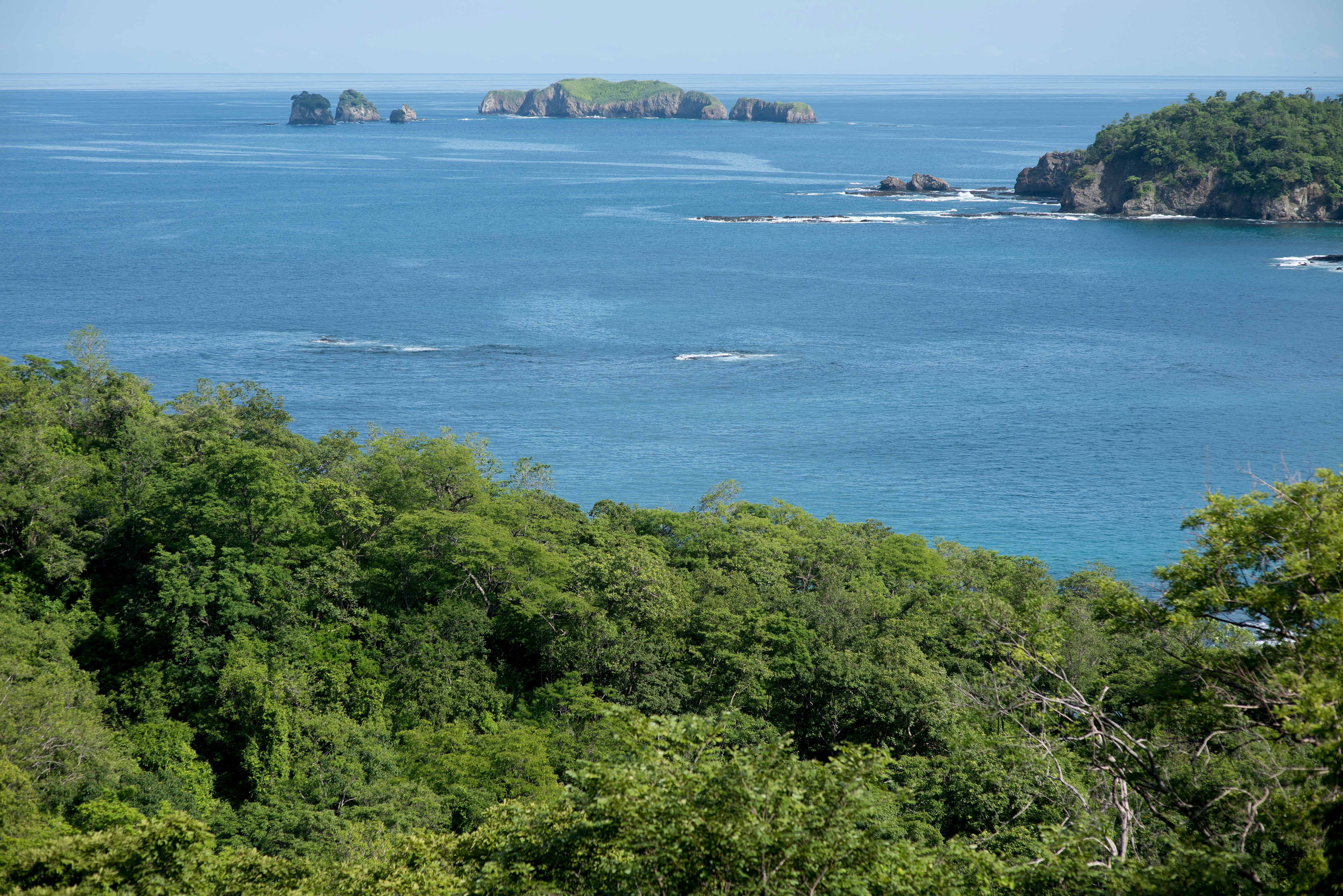
After stopping at the lookout, continue along the J Trail until you reach C1 and C2. From there, hike all the way to C4, where you will find a bench with a privileged view of Punta Guachipelín and the Pitahaya Islands to the left. This perspective is unique, as you are looking directly over the cove of Punta Guachipelín.
At this exact point, the waves arrive from two different angles, crashing against the rocks. The sound and movement of the water are mesmerizing. Watching the power of the ocean here is both grounding and meditative, a reminder of how small we are in the presence of nature’s force. It is refreshing, humbling, and deeply calming.

From C4, you can return by walking back through C3, C2, C1, the J Trail, M2, M1, and back to K1.
If you take your time, stopping at the bench and enjoying the surroundings, this hike can take around 1 hour and 15 minutes. Allow yourself to linger. This is a route meant to be savored.
ADD ON: PUNTA GUACHIPELÍN EXTENSION
If you would like to add about 30 more minutes, instead of turning back at C3, continue toward B1 and complete the full Punta Guachipelín Trail, marked as PG.
This section takes you through C1, B2, and B1. The topography here forms a natural valley, with B2 as the lowest point. Walking through this space feels like sitting in the center row of a theater. The ocean becomes the main stage, perfectly framed before you. You feel like both a spectator and a participant, close enough to feel connected, yet far enough to take it all in.

From B1, continue to A2, then take the switchback trail to A1, which brings you back to Playa Danta.
If you were trail running, this full loop would take about one hour. Walking at a relaxed pace, expect closer to one hour and forty five minutes. Combined with the Lollipop route, this loop offers a beautiful balance of ocean views and moments immersed among towering trees rising from the ground.
3. EASY OPTION B | FAVORITE SUNSET HIKE | ~1 hour
Sunsets are a ritual at the beach, so no trail guide would be complete without a route designed to enjoy them while hiking.
Begin at K1, at the end of Playa Danta. Turn left toward M1 and M2, passing the lookout. From there, continue to B1, then B2 and B3, walking from B3 to B4 and passing through D1. Next, walk from B4 back to B1 along the trail marked on the map as the M Trail.

This is where the magic happens. As you make your way back toward Town, you will watch the sky shift colors over Plaza Manzanillo and Playa Danta while walking along the zig zag path. Continue through the M2 and M1 section, eventually returning to Playa Danta at K1.
In Costa Rica, sunset times vary throughout the year. Make sure to check the sunset time during your visit to Town and start this hike about 45 minutes before sunset to fully experience the changing light and colors.
4. INTERMEDIATE OPTION 1 | EL CIELO (EC) | ~1 hour
This deeply shaded route is an immersive experience, perfect for midday hikes in Guanacaste’s heat.
El Cielo, which translates to “Heaven”, is ideal for intermediate hikers or confident beginners looking for a bit more challenge. The increased incline is what makes this route more demanding, but it remains approachable and rewarding.
This hike is especially recommended for later starts or hotter days. The dense tree cover creates a jungle like atmosphere that keeps the trail cool and shaded. While there are no views, the feeling of immersion in nature is what defines this route.

Begin at B13, across from Casa Chameleon and head to B12, then B11, D13, D12, and H5. This entire section from B11 to H5 is a steady climb. At H5, you will find a sign marked “EC” for El Cielo. Follow the arrow onto the F Trail toward F1, then continue along the H Trail, which loops you back to the F Trail.

To exit, return the same way you entered. Once back at H5, head downhill toward B12. At B13, you will be greeted by a bench where you can celebrate completing the route.
5. INTERMEDIATE OPTION 2 | LONG INTERMEDIATE HIKE | ~2 hours
This route is perfect for intermediate hikers looking to spend more time on the trails. It offers a mix of elevation, views, descents, and long shaded stretches, all in one continuous experience. It is especially well suited for those seeking immersion in nature, reflection, or a moving meditation.

Start at Playa Danta, at marker K1, and walk toward M1 and M2, passing the lookout. Continue to B1 and B2, which is fairly flat, before beginning a gradual climb toward B3. From here, you will walk along the full D Trail.
Proceed from D1 to D4, which remains mostly flat. From D4 to D5, the trail becomes steeper, increasing your heart rate. At D5, you will find an incredible lookout over Playa Manzanillo and will get to see nearby islands that are not visible from Playa Danta.

From there, begin descending until you reach D9, where you will encounter a gate. Cross the unpaved road and re-enter the trails on your left, continuing to D10, which is relatively flat.You’ll encounter a short climb from D10 to D12, before reaching D13. Once there, starts the final descent toward B12 and B13, directly across from Casa Chameleon and the paved road back into Town.
6. ADVANCED | MCHENRY PEAK AND WINDY PEAK | ~1.5 hours
This demanding route begins at B13, across from Casa Chameleon. Start climbing toward B10 and follow the L Trail. The zig zagging path quickly gains elevation, offering a full cardiovascular workout, especially if you are trail running.

Once you reach McHenry Peak, at 205 meters above sea level, you are rewarded with one of the most panoramic views in the area. From here, you can see Town, Playa Danta, Playa Dantita, Sugar Beach, and all the way to Playa Flamingo.

From McHenry Peak, head toward L2, where Windy Peak is located. Despite its name, it is not always windy, but it offers wide ocean views, including sightlines to Zapotal, Pacific Heights, and El Castillo de Lilo in the distance.
Continue downhill to L3, cross the road, then head to L4 and B7. From there, take the I Trail, moving from I1 to A5, and finish at A6. This final descent is steep and can be hard on the quads, especially during dry season when the ground is looser.

Starting this hike about 45 minutes before sunset offers incredible views of the sun lowering over the ocean from the higher peaks. It is also an excellent early morning hike, as higher temperatures later in the day significantly increase the difficulty.
This route is ideal for a fitness challenge. Bring friends, plenty of water, and be ready to earn every view.
_________________________________________________________________________________________________________________________________________________________________________________________
Chapter Five: A living legacy, shaped by movement
After more than seventeen years, it is fair to say that the trail system at Las Catalinas has exceeded every early expectation. Long before the first stone was placed in Town, trails were already being envisioned, traced, and built. What began as the very first amenity of the community remains, to this day, an object of care, devotion, and deep affection.
The trail network is far more than a series of paths. Each route tells a story of intention, patience, and years of thoughtful work dedicated to the enjoyment of thousands of people. Finding a system like this, within a protected ecosystem, with rideable and enjoyable slopes, friendly topography, and immediate proximity to the ocean, is extraordinarily rare. Bringing all of those variables together in one place was a bold bet, one that has proven to be profoundly worthwhile.

Over the years, the trails of Las Catalinas have hosted events of international caliber. Races like the Guanarides grew organically, expanding from a single day to multi day experiences. More recently, XTERRA has chosen Las Catalinas as a recurring host, a recognition that speaks not only to the quality of the trails themselves, but to the infrastructure that supports them. Hosting events of this scale requires world class conditions, from the trail system to accommodations, restaurants, shops, and services throughout Town.
Athletes from around the world have praised these trails for their technical design, flow, and riding surface. Experienced riders immediately recognize the difference when internationally recognized trail building principles are applied. The result is a system that feels intuitive, fluid, and deeply enjoyable, whether experienced at speed or at a slower, more contemplative pace.
Yet the trails are not only shaped by people, they are also home to wildlife and living ecosystems. Sloths, deer, armadillos, countless bird species, fungi, and native plants all coexist along these paths. Moving through the trails means sharing space, quietly and respectfully, with the life that already belongs here.
Over time, these trails have witnessed personal victories and defeats, elite athletes and first time hikers, moments of effort and moments of stillness. More importantly, they have shaped character. Not because they are punishingly difficult, but because the simple act of repetitive movement through nature has a meditative quality. We may leave physically tired, but often we leave mentally lighter.

Beyond sport, there is something deeply human about trails. They create connections. In urbanism, access to nature fosters a sense of belonging and care for place. On foot or by bike, these paths invite us to form relationships with the land and, in doing so, with ourselves. By democratizing access to landscapes unreachable by car, trails offer moments and views reserved for those willing to choose a different kind of path.
The existence of this trail system is remarkable not only because of its early vision, but because of its ripple effects. The knowledge and skills gained by those who built and continue to maintain these trails have traveled far beyond Las Catalinas. Many workers have carried this expertise back to their own communities, opening new connections to land that once felt inaccessible.
When construction of the trails began in 2008 and 2009, there was nothing comparable in the region. While nearby areas now feature trails of their own, experienced riders still feel the difference immediately. Thoughtful design, technical precision, and flow are not accidental, they are learned, practiced, and respected.
Ultimately, the trails of Las Catalinas are not defined by difficulty or distance. They are defined by care and intention, by the quiet understanding that movement through nature has the power to connect us, to place, to others, and to ourselves.
